Coming soon
Puget Sound 3D Topographic Map
$125.00
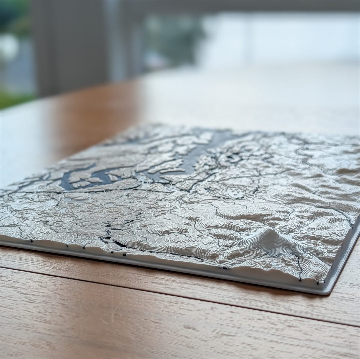
A three-dimensional topographic relief map of the Puget Sound region, rendered in cream and deep navy to mark the line between land and water. Elevation data builds the geography in successive layers, so the terrain on the piece matches the real landscape.
Seattle and Tacoma along the eastern shoreline, the Kitsap Peninsula and the islands the Sound carves around it, Hood Canal reaching inland, and Mount Rainier in the southeast. For anyone who’s crossed the Sound by ferry or caught the Rainier viewpoint off I-5, it’s home.
- Dimensions: 8.7 × 11.6 in
- Material: PLA, matte finish
- Colors: cream + deep navy
- Made to order: ~14 hours print time plus finishing; 1 to 2 weeks before shipment
- Designed to sit flat on a shelf, desk, or mantle
Surface texture variation is characteristic of layer-by-layer printing.